Drone Roof
Inspections
Without The Climb
Fast drone roof inspections and aerial documentation for contractors and property owners across Rhode Island, Massachusetts, and Connecticut.
For Contractors
Fast drone roof inspections and aerial documentation to help with estimates, steep roofs, insurance photos, and project records.
- Same-day or next-day turnaround
- No ladders or roof walking needed
- Clear photos and video for estimates
- Ideal for roofers, builders, and inspectors
For Property Owners
Get a safe, clear view of your roof, property, or hard-to-access areas without climbing or scheduling a full inspection first.
- Roof condition checks
- Storm damage documentation
- Pre-sale or maintenance photos
- Easy-to-understand aerial visuals
Drone Roof Inspections
Get fast, accurate roof visuals without climbing. Perfect for contractors and property owners who need clear documentation, safer access, and faster estimates.
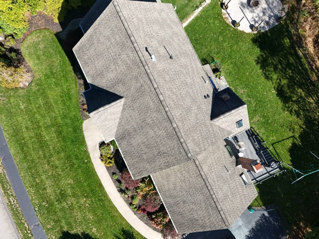
High-Resolution Images
Detailed photos of the entire roof, including problem areas.
Full Aerial Coverage
Complete overhead views to understand layout and structure.
Fast Turnaround
Same-day or next-day delivery so you can move quickly.
See How It Works
Watch how we capture detailed aerial data quickly and safely – with no need to climb on your roof.
What You Get
High-Res Photos
Crisp, detailed images you can trust for estimates, records, and reports.
Full Roof Coverage
Complete aerial views of every section, including hard-to-access areas.
Problem Area Highlights
We help identify visible issues so you can act with confidence.
Additional Contractor Services
Beyond drone roof inspections, Syzygy Mapping & Design supports contractors with technical documentation and fire alarm plan design to help keep projects moving.
Request Contractor SupportFire Alarm Plan Design
Permit-ready fire alarm layouts, device placement support, risers, and documentation backed by 10+ years of design experience.
Project Documentation
Aerial photos and videos for progress tracking, estimates, site records, and client communication.
Contractor Drawing Support
Support for electrical, low-voltage, fire alarm, roofing, and construction teams that need clear visuals or plan documentation.
CONTACT US
Syzygy Mapping & Design combines operations with technical design expertise to give you both the images and the drawings you need to move projects forward.